 vesseltracker.com
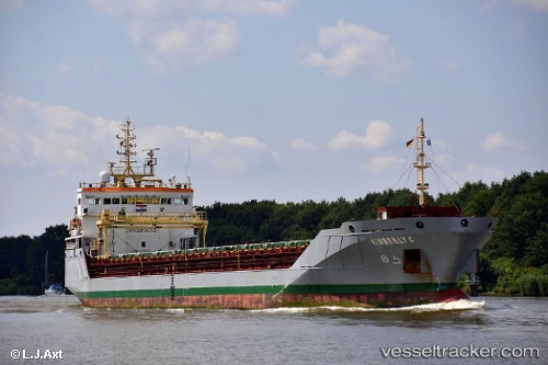
Find the position of the vessel KIMBERLY C on the map. The latter are known coordinates and path.
marine traffic ship tracker show on live map
The current position of vessel KIMBERLY C is 50.63098 lat / 1.25569 lng. Updated: 2025-11-06 21:32:24 UTCCurrently sailing under the flag of Portugal (MAR)
KIMBERLY C built in 2011 year
Deadweight:
6806 tDetails:
Last coordinates of the vessel:
UTC, 50.44599, 0.84558, course: 73, speed: 8.3UTC, 50.47688, 0.99100, course: 49, speed: 8.4
UTC, 50.56826, 1.15267, course: 46, speed: 8.7
2025-11-06 21:32:24 UTC, 50.63098, 1.25569, course: 51, speed: 8.5